 |
|
|
|
Here is a precise what3words address, made of 3 random words. Every 10ft square in the world has its own unique what3words address:
https://w3w.co/lived.indoor.lifelong
|
|
|
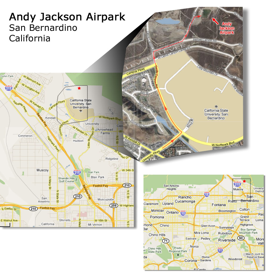
From I-215 in San Bernardino, exit onto University Pkwy and go north. Turn left onto Northpark Blvd. Go past two stop signs. Then go only 200 feet, then turn right onto the first dirt road which is indicated as Badger Canyon Rd. There is also a small "Airpark" sign that's easy to miss. Follow the dirt road for 1/3 mile then left at the fork. |
 Directions: